Hi Overview
DURATION: 1.5-2.5 hours
EQUIPMENT: 200ft rope, 30ft webbing, rap wring, harness, carabiner, belay device, gloves
RAPPELS: 1 (89ft)
WATER: None
FLASHFLOOD: Low
SEASON: Any
NOTES: This trip requires a permit. $2 fee at the visitor center
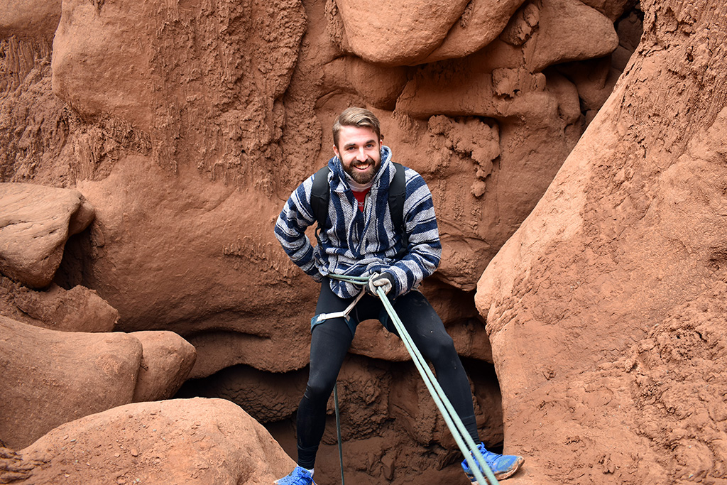
Goblin's Lair canyon has become incredibly popular with beginners and other groups since it became "known". The canyon offers a short approach, short exit, and straight forward rappel, all very good beginner canyon qualities. Though those are all good reasons beginners should do the canyon, the real reason to do it? The very short slot section is amazing! The rappel into the lair is unique and stunning. Beginners and experienced canyoneers alike will enjoy this short route. Hikers can visit Goblin's Lair for the bottom easily, as well, making this a good recommendation even for the non-technical. On a hot day, the Lair provides a welcome respite from the heat and sun.
Getting There
South of I-70 about 25 miles on Highway 24 (about 25 miles north of Hanksville), a signed road goes off to the west signed Goblin Valley. Follow this paved road 5.1 miles to a junction. Go south (left) on the signed road toward Goblin Valley, resetting your odometer. Just before Goblin Valley, 6.0 miles, another junction occurs. Go left here, entering Goblin Valley. Once inside the park, go left again at the junction to reach the view area and Goblin Valley proper.
Route
Approach
Navigation is surprisingly easy given the difficult terrain. From the picnic area/viewpoint, take a minute to orient yourself. To the east is a prominent white butte, the tallest one you can see. To the right of it is an Entrada/Goblin area. To the right of the Goblin area is another white mesa that is shorter and flatter. You are aiming for the valley between the two mesas. There is a small white dome down in the Goblin Valley area proper. The first one you can see looking southeast. It is quite small. Hike to it. A well-traveled trail goes up the small dome. Either go up and over the dome, or around it. Either way, from behind the dome, work you way up the red Entrada formations trending left (north) to the base of the shorter white mesa you saw from the viewpoint. There are many options here. Mostly third class. If it starts getting hard, find a different path. Once at the base of the white mesa, a social trail follows the base of the mesa north (left) to the valley between the two mesas.
Canyon
The head of Goblin's Lair is between the two mesas and drains east (right). There are footprints and social trails all over! You want to head into the very top of the drainage. There are a few small drops in the drainage that are bypassed (generally on the left) via a pretty well defined social trail. A small tunnel about halfway down indicates you on the right track. Suddenly the canyon drops at the rappel. The rappel deposits you in a cavernous room. Fantastic! Scramble out the steep down canyon side and out into the sunlight and land of the living, you made it!
Exit
Once out of the Lair, hike north along the base of the cliffs. It is easiest to go a few minutes away from the cliffs to avoid the deep sand. You will see Molly's Castle in the distance. At the north end of the cliffs, the trail becomes more defined as it becomes Molly's Castle Trail. Follow cairns and a trail back west to the trailhead.
Hiking Route
For hikers wishing to visit the Lair from the bottom, take the Molly's Castle Trail from the view area. Follow it to its end (15-20 minutes), and then continue south along the cliffs. About 5 minutes from the end of the trail, a small sandstone tower is on the left. Goblin's Lair is in the cliffs on the right almost across from this. You will need to hike up a sandy hill to be able to see the entrance.
Waypoints
Map
Photos

IMAGE CAPTION HERE

IMAGE CAPTION HERE

IMAGE CAPTION HERE

IMAGE CAPTION HERE

IMAGE CAPTION HERE

IMAGE CAPTION HERE

IMAGE CAPTION HERE

IMAGE CAPTION HERE

IMAGE CAPTION HERE

IMAGE CAPTION HERE

IMAGE CAPTION HERE

IMAGE CAPTION HERE

IMAGE CAPTION HERE

IMAGE CAPTION HERE

IMAGE CAPTION HERE

IMAGE CAPTION HERE

IMAGE CAPTION HERE

IMAGE CAPTION HERE

IMAGE CAPTION HERE

IMAGE CAPTION HERE

IMAGE CAPTION HERE

IMAGE CAPTION HERE

IMAGE CAPTION HERE

IMAGE CAPTION HERE

IMAGE CAPTION HERE

IMAGE CAPTION HERE

IMAGE CAPTION HERE

IMAGE CAPTION HERE

IMAGE CAPTION HERE

IMAGE CAPTION HERE

IMAGE CAPTION HERE

IMAGE CAPTION HERE

IMAGE CAPTION HERE

IMAGE CAPTION HERE

IMAGE CAPTION HERE

IMAGE CAPTION HERE

IMAGE CAPTION HERE

IMAGE CAPTION HERE

IMAGE CAPTION HERE

IMAGE CAPTION HERE

IMAGE CAPTION HERE

IMAGE CAPTION HERE

IMAGE CAPTION HERE

IMAGE CAPTION HERE

IMAGE CAPTION HERE

IMAGE CAPTION HERE


